Verifiable accuracy - why you need ground control

The takeaway:
If your accident reconstructionist tells you they used a drone to model and measure evidence ask them if they used ground control points and checkpoints!
Drones - They’re Everywhere
Consumer drones have made aerial imagery accessible to just about everyone. It’s now easier than ever to take to the skies and capture breathtaking perspectives of the world below. Many drones even come with software that allows the pilot to automate flights and capture hundreds of photographs with little effort. A free trial subscription to photogrammetry software (e.g. Pix4D, DroneDeploy, etc.) can then take those images and stitch them together to make a full three-dimensional model of the photographed area. It’s simple enough that any remotely tech-savvy person could start making three-dimensional models within days of buying their first drone, as many accident reconstruction professionals have done.
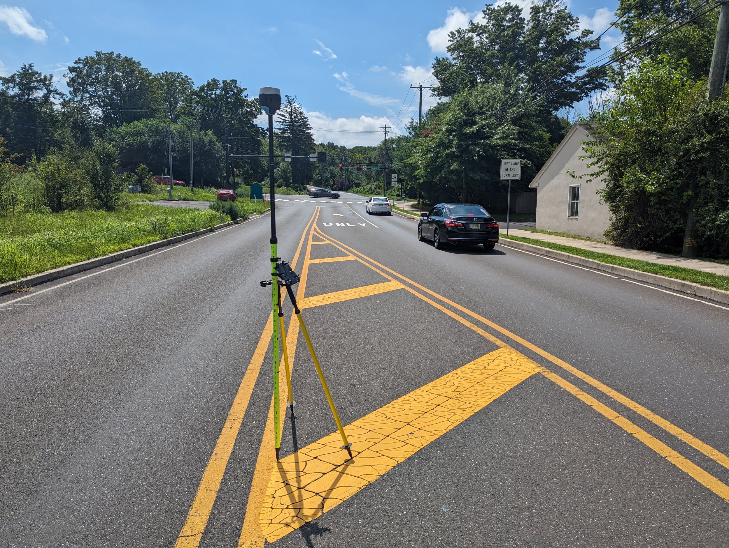
But stunning imagery and beautiful models aren’t good enough for forensics! We need accuracy that can be verified and measured. Fortunately, when properly implemented, precision GPS devices (like the GNSS receiver mounted to the yellow pole in the cover photo) allow us to take highly accurate measurements of discrete points on the face of the earth. These points are often called “control points” and they are the key to verifiably accurate drone models that can be relied upon to take measurements and reconstruct a crash.
Getting Under Control
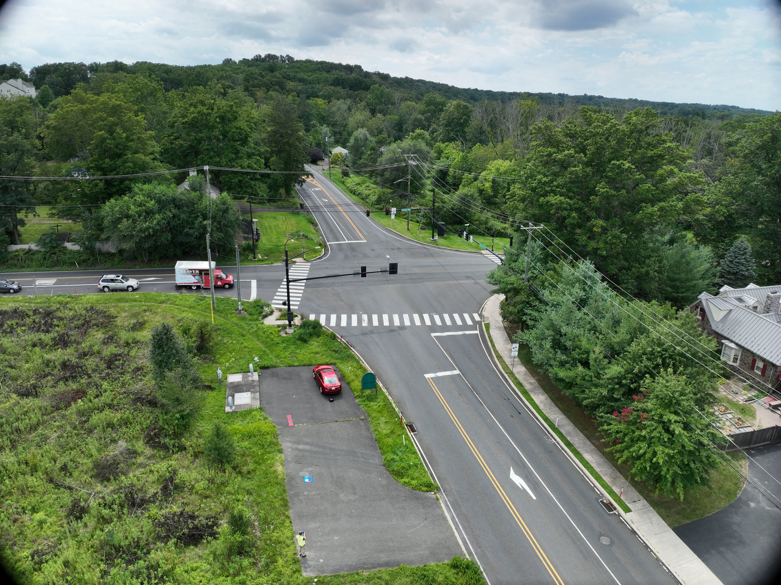
Several months ago Evident flew two mapping missions (a technical term for automated drone flights designed to capture hundreds of photographs of the desired area) over an intersection here in Doylestown, Pennsylvania. One mission was flown without the use of control points or precision GPS positioning, such as real-time kinematic (RTK) corrections, and the second mission was flown with control points and RTK corrections. The photographs collected during each mission were used to create two separate three-dimensional models of the intersection for comparison.
The intersection of Bristol Road and Upper State Road was just right for the needs of the study and provided plenty of permanent markers to use as checkpoints (checkpoints are much like control points but they are only used to independently check the accuracy of the model where control points are used to make the model). In this study, we’re interested in the surface of the road so all six of the study’s checkpoints were placed on the surface of the road. An additional five control points (referred to as GCPs or ground control points hereafter) were placed around the site where space would allow - on sidewalks and grassy areas where they would not be disturbed.

Orthomosiac of the subject intersection with GCPs circled in yellow and check points in red.
(Note: The model was cropped to remove private homes and yards.)
After selecting the checkpoints and placing the GCPs, each of their positions were recorded using a GNSS receiver with RTK corrections coming from a local base station. With all controls measured and in place, flight plans were created to fly and photograph the intersection from 150ft above ground level. Here’s the simple breakdown and the naming convention we’ll use to discuss the models we’ll be comparing:
No Control Model
GPS positioning during flight.
GCPs and checkpoints were all used strictly as checks and were not used to align the model.
Control Model
GPS positioning with RTK corrections during flight.
All Five GCPs were used during the alignment stage of model reconstruction.
All six checkpoints were used strictly as checks and were not used to align the model.
Results - Absolute Accuracy
Absolute accuracy is all about geolocation and refers to how accurately we were able to locate the positions of features within the models to their actual positions on earth. Think of it this way: If we dropped the model into a program like Google Earth, how accurately could we measure distances from objects observable inside of the model to places on earth that lay outside of the model?
Absolute accuracy is where the No Control Model really struggled. The drone’s onboard GPS is simply insufficient to capture very precise positions. The tables below report the deviations between the location of the control points calculated by the model and their true location measured by the RTK GNSS receiver before the flights. Here’s a summary of the finidings:
No Control Model - The GCPs (which were only used as checkpoints for this model) and checkpoints had a root mean square (RMS) error of more than 1.5ft in the X direction, 4ft in the Y, and 15ft in the Z! (X-Y directions are side to side on the ground while the Z direction is the elevation).
Control Model - The checkpoints had an RMS error of less than half an inch in the X and Y directions and a little over 1.5 inches in the Z direction.


Results - Relative Accuracy
Here we’re focused on the accuracy of measurements taken between two points that are both located within the model. A program called CloudCompare was used to overlay the No Control Model with the Control Model. CloudCompare then calculated the distances between the two models and a heatmap was generated to highlight the areas where the No Control model deviated from the Control Model.
A note on alignment of the models: Even though we know the models deviate from each other, common points on the models need to be selected and used to align them with each other for comparison. We opted to select three points within the intersection for use aligning the models. The decision was in part because the intersection had lots of painted markings that were easy to pick points from, because the intersection was the most photographed region in the model (due to overlapping flight paths over the roads), and because the intersection was relatively flat and level compared to the surrounding roads. As a result of this choice, the models deviate the least within the intersection (blue in the heatmap).
The heatmap below speaks for itself so we’ll make the remarks short here. The environment used for this study proved to be challenging for the No Control Model with deviations of up to about three inches in the blue regions, up to about a foot in the green regions, and up to about a foot and a half in the yellow to orange regions.

Heatmap demonstrating where, and how much, the No Control model deviates from the Control Model.
(Units are in feet)
The No Control Model appeared to have been particularly sensitive to the elevation changes in the roads, where the blue intersection gave way to green and yellow. A digital surface model (DSM) of the Control Model nicely demonstrates of the deviations show in the heatmap correspond with elevation changes in the DSM .

Digital Surface Model of the subject intersection. Color changes represent elevation changes.
What does this all mean for measurements taken on the surface of the road?
As an example, linear measurements taken from the No Control Model came up more than four inches short for the width of the crosswalk crossing Bristol Road (which measured just over 46ft).

Crosswalk crossing Bristol Road
Final Thoughts
If you want models that can be confidently used for measurements:
Check Points are necessary - You don’t know anything about the accuracy of the model without them!
RTK corrections to the drone are nice to have and greatly improve absolute and relative accuracy.
Ground Control Points and/or scale constraints are still a good idea when using RTK drones and are likely required when RTK corrections are not used and the terrain isn’t flat and level.
There subject of photogrammetric accuracy is highly technical and requires an understanding of geospatial data that is usually reserved for professional surveyors. There is a science to selecting the number and placement of ground control points and checkpoints depending on the features of the area being modeled. Precisely and accurately measuring the location of the control and checkpoints also requires an understanding of the GNSS receivers used to make the measurements. In short - there’s lots of room for error without proper training and procedures.